Vehicles #
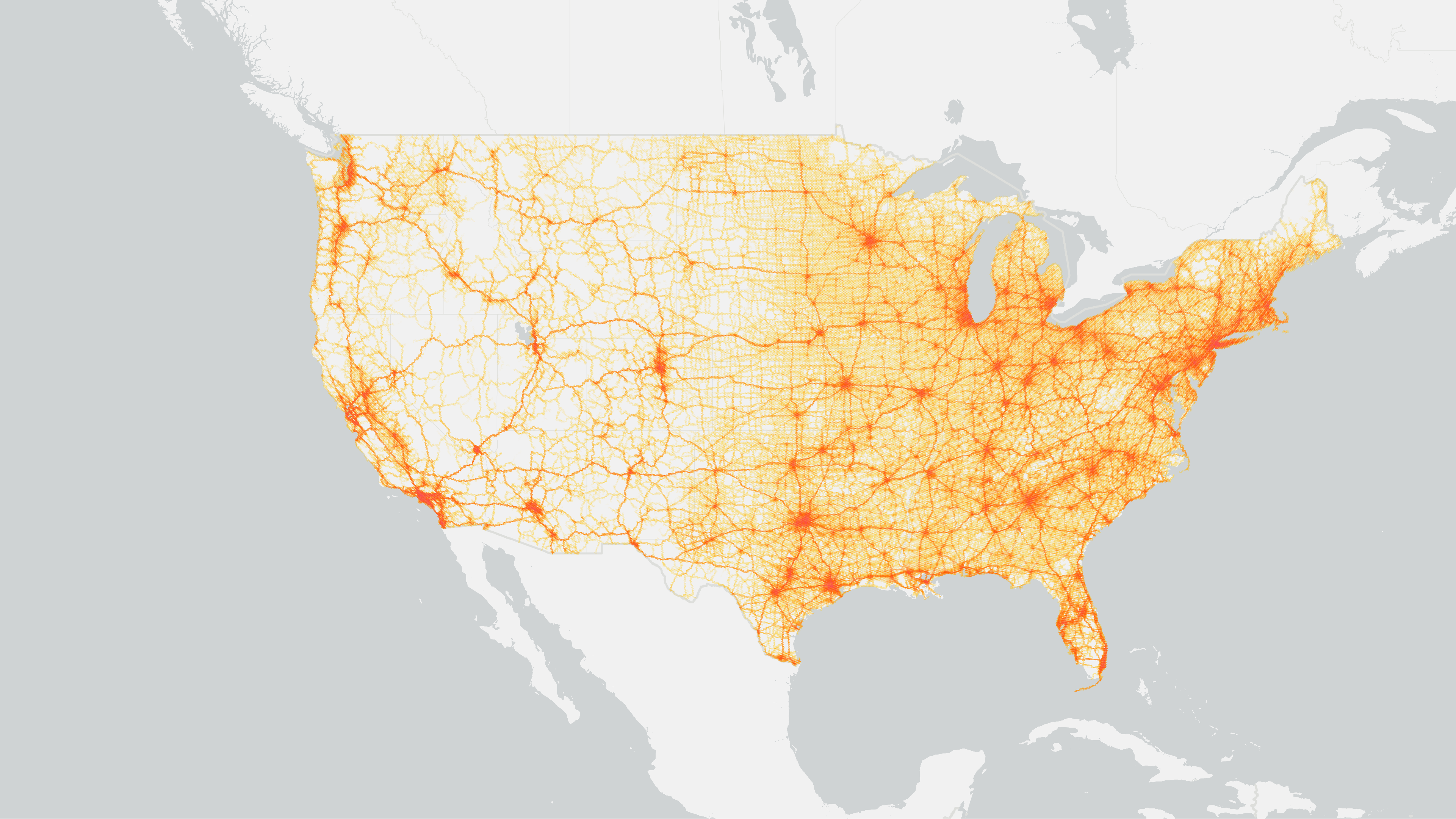
The onroad sector returns CO₂ emissions for onroad vehicles based on a combination of GPS-based traffic data, fuel consumption data from the U.S. Energy Information Administration (EIA), fuel share types from the US Department of Transportation (DOT) Transportation Energy Data Book: Edition 40 (TEDB), traffic statistics from the Federal Highway Administration (FHWA), emissions inventories, detailed maps of roads from OpenStreetMap (OSM), and population from the US Census Bureau. Parking-related CO₂ emissions are included in onroad and represent emissions from parking-related activities such as hoteling using EPA, NEI, United States DOT, Federal Highway Administration (FHWA), and EPA Spatial surrogates data.
Vehicles/Onroad Sector Definition #
This sector returns segment-level CO₂ emissions representing non-electric vehicles driving on roadways. Emissions from other off-highway vehicles are not included in this sector (e.g. construction equipment, agriculture/forestry vehicles, golf carts, etc.).
Parking Sector Definition #
The parking sector encompasses parking-related activities such as hoteling. The NEI defines hoteling as “any long period of time (e.g., > 1 hour) that drivers spend in their longhaul combination truck vehicles during mandated rest times.” Using NEI hoteling data, the EPA Spatial surrogates data and FHWA Highway Statistics hoteling hours, gallons of fuel and CO₂ emissions are modeled to points from the county level reporting.
Emissions data sources #
- Commercial road segmentlevel Vehicle Miles Traveled (VMT) data (48 states - not Alaska and Hawaii)
- Federal Highway Administration (FHWA) Average Annual Daily Traffic (AADT) shapefiles for Alaska and Hawaii
- FHWA Highway Statistics Series for 2010-2022
- US Department of Transportation (DOT) Transportation Energy Data Book: Edition 40 (TEDB)
- US Energy Information Administration (EIA) Annual Energy Outlook (AEO)
- EIA State Energy Data System (SEDS)
- OpenStreetMap
- US Census Bureau Topologically Integrated Geographic Encoding and Referencing system (TIGER)/Line and American Community Survey 5-Year Data
- EPA National Emissions Inventory (NEI)
- EPA Spatial surrogates
Methods summary #
For onroad vehicles the methods involve associating VMT with various FHWA datasets and Transportation Energy Data Book tables to calculate CO₂ emissions. For Alaska and Hawaii, VMT is calculated using FHWA HPMS data and scaled to match state-level totals. Fuel consumption is adjusted using state-specific fuel economy and SEDS data. Historical VMT is estimated using a regression model based on road length and population, constrained by statelevel VMT and fuel data, with CO₂ calculated using year-specific fleet and fuel characteristics. Parking methods involve merging hotelling hours data with FHWA and NEI datasets by state and vehicle class, and interpolating hoteling hours using VMT for combined trucks. Hotelling hours are distributed across parking locations provided by the EPA, based on the number of parking spaces per county. CO₂ emissions at each location are calculated using emission factors and fuel consumption rates, based on hoteling hours.